


Chiltern Hills North - Explorer 2
Publisher: Ordnance Survey
Format: Paperback
ISBN: 9780319217023
Chiltern Hills North – Explorer 2 (1994) – Ordnance Survey
Ordnance Survey | Explorer Series | ISBN: 9780319217023
Condition: Good | Sold by Crappy Old Books
The Chiltern Hills. A magnificent stretch of English countryside where rolling chalk hills, ancient beech woodlands, picturesque villages and winding footpaths combine to provide the perfect escape from modern civilisation. Here, the air is fresh, the views are splendid, and the average walker can spend an entire afternoon discovering that the charming little hill on the horizon is considerably steeper than it appeared from the pub car park.
Welcome to Chiltern Hills North – Explorer 2, a splendid 1994 Ordnance Survey map from the days when navigating the British countryside required paper, patience and the ability to distinguish a footpath from a suspiciously similar-looking sheep track.
Published at the wonderfully detailed 1:25,000 scale, equivalent to four centimetres representing one kilometre on the ground, this Explorer map provides an intricate picture of the northern Chilterns, revealing the roads, paths, woodland, contours and rural features that make the landscape such a delight to explore.
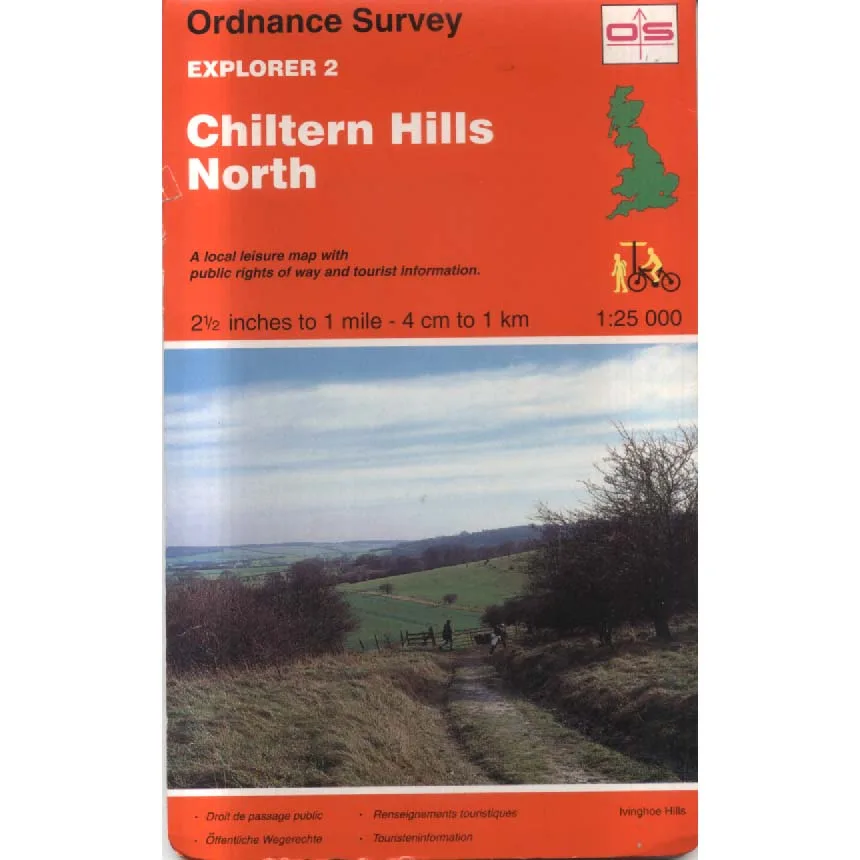
The cover proudly announces its credentials as a local leisure map, complete with public rights of way and tourist information. In other words, everything required to plan a thoroughly enjoyable day in the countryside, apart from suitable footwear, sandwiches and the ability to persuade one’s companions that another five miles would be character-building.
The northern Chilterns offer some of southern England’s most attractive walking country, with sweeping views, peaceful valleys, ancient settlements and woodland paths winding through landscapes shaped by centuries of farming and human activity.
The cover photograph, featuring the countryside around Ivinghoe Hills, provides a particularly appealing introduction to the region. It depicts the sort of inviting rural track that appears perfectly manageable until the weather changes, the ground becomes muddy and somebody announces that the car is parked on the other side of the hill.
Naturally, Ordnance Survey has recorded everything with extraordinary precision. Footpaths, bridleways, field boundaries and contour lines appear in their proper places, providing reassurance that even if the walker has absolutely no idea where they are, the map certainly does.
Published in 1994, this edition also offers a fascinating historical snapshot of the Chiltern landscape before more than three decades of subsequent changes. Roads, paths, settlements and local features may have altered, making older maps particularly interesting to historians, collectors and anyone curious about the gradual transformation of the English countryside.
There is something wonderfully nostalgic about the bright orange-red Explorer cover, with its familiar Ordnance Survey branding and little walking and cycling symbols. It belongs to an era when planning an outdoor adventure involved unfolding a map across the kitchen table rather than consulting a telephone that also insists upon delivering unwanted news and advertisements.
This 1994 Ordnance Survey Explorer 2, offered in Good condition by Crappy Old Books, is an appealing acquisition for walkers, collectors of vintage maps, local historians and enthusiasts of the Chiltern Hills.
A charming cartographic record of one of England’s most attractive landscapes, combining practical geographical detail with the appeal of a bygone era of countryside exploration.
And unlike modern satellite navigation, this map will never lose its signal, demand a software update or announce that your destination is 200 yards away while you’re standing in the middle of a field.
Although it won’t tell you where the nearest pub is still open, either.
Some things, regrettably, remain beyond the capabilities of even the finest British cartography.
Keep browsing: See more Maps books Other books by Ordnance Survey
